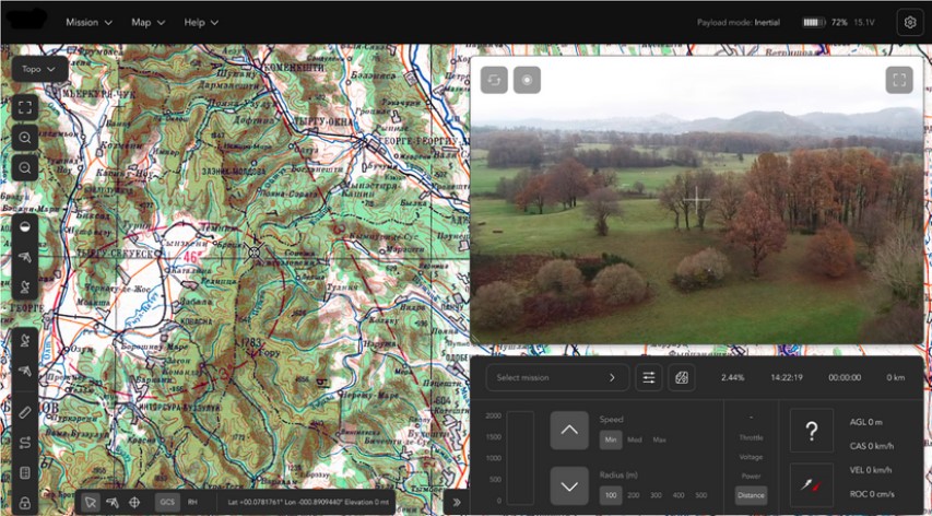
The RD-MCS application includes sophisticated mission planning tools:
- Line of sight calculator – the software can automatically calculate the line of site coverage of the GCS, by using the DTED digital elevation map. The operator defines the location of the mission area, the software “scans” the mission area and displays the minimum flight altitude for line-of-sight coverage.
- Database management tool – the RD-MCS contains database files for the following:
- Flight plan routes – up to 100 coordinates for each route
- No comm. routes – up to 30 coordinates for each route
- Flight zone – endless number of coordinates for each flight zone polygon
- No fly zone – endless number of coordinates for each no fly zone polygon
- Recovery – recovery point and descend point coordinates
- Targets (screenshots, coordinates, time/date, special notes)
- Automatic checklist – normal and emergency checklists are an integral part of the RD-MCS system. The emergency checklists are initiated automatically when the operator clicks on a red indicator.
- Altitude check and plan – all routes are displayed on a side view. The RD-MCS scans the path between each two points, and displays the terrain elevation, and the line of site altitude between each two points. Automatic logic prevents entering two coordinates at a too low altitude with a risk of the AV crashing into the ground.

 Download the brochure